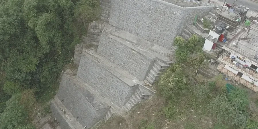
Pittsburgh's topography—cut by the Monongahela, Allegheny, and Ohio rivers—creates over 90 distinct hillsides, many underlain by the Pittsburgh Coal Seam and cyclothem sequences of shale, sandstone, and limestone. What we see repeatedly in Allegheny County is that residual and colluvial soils on these slopes, often only 3 to 10 feet thick over weathered bedrock, fail along the soil-rock interface after heavy rain or freeze-thaw cycles. Our slope stability analysis work across the city integrates subsurface data from test pits to map the colluvium-bedrock contact with precision before any limit-equilibrium modeling begins. The geological complexity here, with claystone layers dipping toward the rivers, demands more than a textbook approach—it requires field-calibrated shear strength parameters tied to actual Pittsburgh formation stratigraphy. When we run Spencer or Morgenstern-Price analyses, we reference back to the ASTM D1586 blow counts and Atterberg limits obtained from the SPT drilling campaign, not just regional defaults.
Pittsburgh's weathered shale slopes degrade cohesion within a single freeze-thaw season—long-term drained conditions control the design, not short-term stability.
Scope of work in Pittsburgh
Local geotechnical conditions in Pittsburgh
In Pittsburgh, the most overlooked risk is the reactivation of ancient landslide blocks when toe excavation proceeds without staged benching. We have walked sites in Squirrel Hill and Mount Washington where a contractor opened a 15-foot vertical cut at the slope base, unknowingly daylighting a pre-existing slip surface in the claystone. The slope failed within 48 hours after a 2-inch rain event. A proper slope stability analysis before excavation would have identified the residual shear strength along that slickensided surface through laboratory ring shear testing on the Pittsburgh red bed clay, yielding φr values as low as 12 degrees. Another common issue is the mischaracterization of fill—Pittsburgh has extensive historical slag and fly ash fills on steep ravines that behave differently from natural colluvium. Our analyses explicitly model these anthropogenic materials with their highly variable cohesion and friction angles, using back-calculated parameters from instrumented slopes. Ignoring the groundwater perched on the weathered rock surface is equally dangerous; we install standpipe piezometers in every boring and update the phreatic surface monthly during the rainy season before finalizing the design factor of safety.
Our services
Our slope stability analysis in Pittsburgh covers the full lifecycle from preliminary site reconnaissance through post-construction monitoring. We tailor each scope to the geologic unit encountered—whether it's the Casselman Formation or the Glenshaw Formation—and the specific failure mode risk at the site.
Limit Equilibrium Modeling
2D cross-section and 3D surface analyses using Slide, SLOPE/W, or SVSlope with Spencer and Morgenstern-Price methods, incorporating Pittsburgh-specific stratigraphy and groundwater conditions.
Finite Element Analysis
Plaxis 2D/3D modeling for complex slope geometries, staged excavation sequences with berm installation, and soil-structure interaction with retaining walls or tieback anchors.
Field Instrumentation & Monitoring
Installation and data interpretation of inclinometers, piezometers, and survey monuments to track slope movement and groundwater fluctuation across Allegheny County hillsides.
Remediation Design & Peer Review
Design of slope stabilization measures including anchors, soil nailing, and drainage systems; third-party technical review for Pittsburgh municipal submissions.
Quick answers
What triggers slope failures in Pittsburgh's geology?
The primary triggers we document in Allegheny County are prolonged rainfall events saturating the colluvial layer above weathered shale, and freeze-thaw cycles that degrade the Pittsburgh red bed claystone's cohesion. Rapid snowmelt in late winter, combined with frozen ground preventing infiltration, generates surface runoff that erodes slope toes. The soil-rock interface at 3 to 10 feet depth acts as a preferential slip plane when pore pressures build. Construction-related triggers include unplanned toe excavation and uncontrolled blasting that fractures the already-jointed bedrock, allowing water ingress into previously dry joints.
Which factor of safety do Pittsburgh codes require for permanent slopes?
Under IBC 2018 and ASCE 7-16, we target a minimum static factor of safety of 1.5 for long-term drained conditions on permanent cut and fill slopes. For pseudo-static seismic conditions—Pittsburgh lies in a moderate seismic hazard zone with a 0.1-second spectral acceleration around 0.15g to 0.20g on Site Class D—we require a minimum FoS of 1.1. These values align with PennDOT Publication 293 and FHWA guidelines. Critical slopes adjacent to occupied structures or public rights-of-way often warrant higher targets of 1.3 to 1.5 pseudo-static depending on the consequence class.
What does a slope stability analysis cost in the Pittsburgh area?
For a typical single-family residential or small commercial hillside lot in Pittsburgh, a complete slope stability analysis—including field investigation with SPT borings or CPT soundings, laboratory triaxial testing, piezometer monitoring over one wet season, and final limit-equilibrium modeling—ranges from US$1,210 to US$4,210 depending on slope height, access constraints, and the number of cross-sections required. Larger developments with multiple slope faces, 3D modeling, or remediation design are scoped and quoted separately after a site walk.